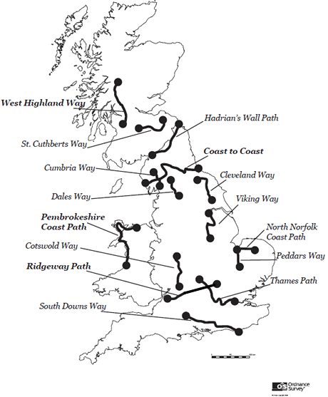
Time taken and distance per day arranged by the individual
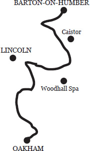
VIKING WAY
The Viking Way walk starts at the road bridge across the Humber Estuary, and the river is followed to South Ferriby before heading south to the quiet villages of the Lincolnshire Wolds, via the market town of Caistor which still has its Roman walls. As the trail approaches Woodhall Spa it is possible on a clear day to see Lincoln Cathedral over 20 miles away, riding high on a limestone bluff from the surrounding fenlands.
Into Lincoln and out of it the path follows the River Witham through the fens and across Lincoln Heath, an isolated place. The towpath of the Grand Union Canal eventually takes the route over the boundary into Leicestershire. Following the northern shore of Rutland Water the path arrives at Oakham, your final destination.